All Articles
Finding Gold With Copper and Turquoise
August 2009 by Chris Ralph
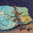 The signs of copper, which the prospector most commonly sees in the field in outcrops and on the surface, are secondary minerals caused by the action of air and water on the original copper-bearing sulfides that were deposited deep...
Melman on Gold & Silver
 ...we are witnessing the onset of a major transformation of the underlying economic/political structure, perhaps headed toward government controls beyond any previous American experience.
Gold at Dale, California
The Dale Mining district is located in the Pinto Mountains, 18 to 25 miles east and southeast of Twentynine Palms, by way of the Twentynine Palms highway and the unpaved Gold Crown road.
Conrey Dredge No. 4
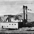 The large buckets were favorable for the type of ground worked. The gravel was tenacious and compact, due to the existence of irregular pockets of clay.
Ask The Experts: What is a Spanish needle?
Some fellow in Texas was selling a Spanish needle—a dousing device used to recover minerals in the old days. Do you know anything about these?
Collector Reaches New Lows to Find Bottles
Not everyone would admit to digging through old outhouse pits, but George Piasecki says it's all part of the game for a bottle collector.
Legislative and Regulatory Update
Alluvial Paystreaks
 The gravels in contact with the bedrock or false bedrock base are often the richest. The same facts apply to the alluvial paystreaks that are formed on gravel bars; the lowest level of the gold-bearing gravel is normally the richest.
Subscription Required:
The Bawl Mill
• Legislative and Regulatory Update
• GM to Cancel Mining Contracts
• California Suction Dredging Update
• Newmont Fined for Fatality
• The Memorial Day Nugget
• East Coast Prospecting Challenges
• Saving Money on Mining Gadgets
• BLM Increases Location & Maintenance Fees
• Rio Tinto: Allegations Without Foundation
• National Mining Hall of Fame to Induct Five
• Melman on Gold & Silver
• Mining Stock Quotes and Mineral & Metal Prices