All Articles
The Art of Finding Coarse Gold Part II—Pocket Hunting for Residual Placers
January 2005 by Chris Ralph
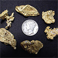 It is a fact that many of the well-known placer districts of the Western US have small veins that contain sparse pockets of coarse gold as their source. This is the main reason why many rich placer districts have seen little or no hard rock mining...
Sons of Gwalia & Herbert Hoover
The Sons of Gwalia mine is situated in the Eastern Goldfields region of Western Australia. It was found by a group of Welsh prospectors in 1896. Gwalia simply means Wales; hence, it was Sons of Gwalia who found the mine.
The Bawl Mill
• Homeowner decides it’s time for change...
• Money for nothing...
• Representatives bring home the bacon...again
• Two cents for your thoughts
Legislative and Regulatory Update
• Bush probably could take back monuments. But would he?
• Oregon Group Needs Your Help
• Critical Habitat Proposed for California Red-legged Frog
Melman on Gold & Silver
These moves were the first serious interruption to the bull market, which had not encountered a serious decline since the election of November, 2016. Since general market moves have been one of the most reliable historic indicators of precious metals market moves, we take a close look at these developments.
When Legends Were Made and Fortunes Found
Sylvester Smith and his younger brother Nathan were among this group who rode and led their Indian ponies, while climbing the rugged Salmon River breaks and rockhewn mountains, looking for a path that would lead them up and over the uncharted wilderness.
The Lucky Shot Mine
I hobbled around on the broken up, sorted rock pile. Watching where I stepped, I kept my eye open for quartz with a gray-blue color imbedded throughout the samples I picked up.
Detecting at Old Hydraulic Mines
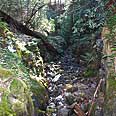 I finally got out recently for my first full, long weekend prospecting trip of the year. Normally I would have been out much sooner, but we had a real late spring in the Sierra Nevada this year with lots of late rain and snow continuing through all...
Subscription Required:
The Bawl Mill
• Convention Report
• Interview with Congressman Gibbons on Mining Law Reform
• Gold Canyon Resources Targets Gallium
• Tucson Mountain Chaos
• Picks & Pans: Auburn Ravine Gold
• Suit Filed to Stop Mining in Northern California
• Niobium and Tantalum
• The Iola Mine Group, Montgomery County, North Carolina
• Effectively Using a Detector and Drywasher for Placer Gold
• Mining Companies Use Conservative Valuations
• Company Notes
• Accident at Robinson Mine Leaves Two Dead
• Looking Back
• Melman on Gold & Silver
• Mining Stock Quotes and Mineral & Metal Prices