All Articles
Legislative and Regulatory Update
November 2004 by Staff


US Senator Conrad Burns (R-Montana) has gained approval from the Senate Appropriations Committee for a measure that would delay the recent hike in mining claim fees until the federal government develops a system to track mining permits and addresses the delays in obtaining mining permits. The measure was tacked onto the Interior Department appropriations bill (S 2804).
The House would also have to pass the measure. Don’t look for a conclusion anytime soon, as the Senate adjourned to campaign and won’t be back in action until November 16, and the bill may not reach a vote until December.
NMA director Laura Skaer called permit delays the “single biggest impediment to mining and exploration in this country.”
The Bureau of Land Management raised the yearly fee from $100 to $125 per mining claim on September 1, and hiked the initial filing fee from $25 to $30. The bill would reduce the fees and require refunds.
For federal land acquisition, the Senate and House are going different directions. The House approved $49 million with no additional money for new acquisitions, while the Senate committee approved $217 million to allow for additional purchases.
• New bull trout plan released
The US Fish & Wildlife Service released a new plan to address bull trout habitat that favors local conservation and preservation efforts over federal control.
The new recovery plan would designate approximately 1,750 miles of streams and 61,235 acres of lakes and reservoirs in Idaho, Washington and Oregon as critical habitat.
Federally designated critical habitat would drop to zero in Montana because Montana has demonstrated they can successfully handle bull trout habitat without federal intervention. Federally designated critical habitat for bull trout in that state was previously pegged at 3,300 stream miles and nearly 220,000 acres of lakes in 2002.
Reductions in other states were also significant.
In Oregon, the new plan would designate 706 miles of streams and 33,939 acres of lakes, down from nearly 4,000 stream miles and 78,000 lake acres in 2002.
In Washington, the new plan would designate 737 miles of streams and no lakes, down from 2,500 stream miles and 30,000 lake acres in 2002.
In Idaho, 306 miles of streams and 27,296 acres of lakes would be designated as critical habitat, down from nearly 9,000 stream miles and 205,000 lake acres in 2002.
The agency determined that Washington State’s Forest Practices Act provided conservation benefits for the bull trout in Washington that are “far superior to the benefits provided by a critical habitat designation,” said Craig Manson, assistant Interior secretary for fish, wildlife and parks.
The new plan also takes into account vast areas covered by the federal Northwest Forest Plan, which Manson called a “long-standing, ongoing effort that adequately protects the habitat the bull trout needs.”
Additional information is available on the Internet at: http://species.fws.gov/bulltrout
• Comments needed
The deadline for commenting on the proposal for individual states to take over management of roadless areas is fast approaching. Comments are due by November 15, 2004.
Written comments may be sent to: Content Analysis Team, Attn: Roadless State Petitions, USDA Forest Service, P.O. Box 221090, Salt Lake City, UT 84122; by fax to (801) 517-1014; or by email: statepetitionroadless@fs.fed.us
The US Fish and Wildlife Service has proposed to designate critical habitat for the southwestern willow flycatcher, a species of bird. The critical habitat would impose restrictions on 376,095 acres, including 1,556 miles of streams and riparian areas in southern California, southern Nevada, southwestern Utah, south-central Colorado, Arizona, and New Mexico.
Comments are due by November 26, 2004. Written comments can be sent to Steve Spangle, Field Supervisor, US Fish and Wildlife Service, AZ Ecological Services Office, 2321 West Royal Palm Road, Suite 103, Phoenix, AZ, 85021; faxed to (602) 242-2513; emailed to wiflcomments@fws.gov
The proposed rule is available on the Internet at www.regulations.gov/freddocs/04-22394.htm
Those without Internet access can contact Steve Spangle at (602) 242-0210 for more information.


Authorities Search for Lost Treasure Hunters
Rescue workers were searching a rugged Arizona wilderness area in triple-digit temperatures for three Utah men who went missing on July 11, while looking for the legendary Lost Dutchman Gold Mine.
Arizona Mines and Minerals Releases New Directory
The Directory of Active Mines in Arizona-1999, just released by the Arizona Department of Mines and Mineral Resources, reflects the strength and diversity of the Arizona mining industry.
First Load of Concentrate Leaves Reopened Ruth Mine
 Five years after depressed copper prices forced the Robinson mine to shut down, the first truckload of concentrate pulled out in what its new owner sees as a renewal of the facility and Ely-area residents hope is a rebirth of the region.
The Reynolds (Star) Gold Mine
The Reynolds gold mine is located approximately 6 miles northeast of the town of Troy, North Carolina, the county seat of Montgomery County. According to old reports, the mine was discovered around 1800. Production reports from the mine are sketchy, but mention the occurrence of telluride minerals associated with the gold. Early work was apparently confined to a number of quartz veins that traverse the property in a northeasterly direction.
Mud Men: Pocket Miners of Southwest Oregon Part III
The amount of gold in the traces from the low-grade scattered veinlets may be much more than the traces from the small but rich pocket, at least until the pocket hunter closes in on the rich pocket. Further confusion arises if the prospector stumbles across a placer deposit on one of the higher peaks.
PLP Members Win Occupancy Case—Appeals Continue
Public Lands for the People (PLP) members Ron Lex and his mining partner Ken Waggener of Etna, California, were cited for occupying their mining claim in Klamath National Forest for more than 14 days. The section cited was Code of Federal Regulations (CFR) 261.10(b). This CFR states that a special use authorization must be obtained for occupying a claim on National Forest land for more than 14 days. In some forests the time is 30 days.
The Treasure Detective—Part II
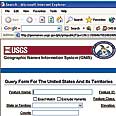 GNIS is an acronym for the “Geographic Names Information Service” that is maintained by the United States Geological Survey. The database catalogs and standardizes place names in the United States. This information set has nearly 2,000,000...
Subscription Required:
The Bawl Mill
• Editorial: Montana's Controversial Rock Creek Mine
• First Load of Concentrate Leaves Reopened Ruth Mine
• Uranium Industry Enjoys Rebound as Prices Nearly Triple
• BLM Warning About Purchase of Mining Claims on the Internet
• Determining the Amount of Gold in a Quartz Specimen
• Placer PGMs in Coon Creek, California
• Getting Your Float Circuit Layout Right
• Pick Up Austria's New Coin—If You Can Lift It
• New Prospecting Guides Available Online
• Police Extend Detention of Newmont Executives
• Picks & Pans—Drywashing and Detecting in Southern California
• Over The Divide—Merwin (Merv) H. Hemp
• The Boludo Placers, Sonora
• The Golden Highway—Placer County
• Northwest Miners Rally a Success
• Mine Threat Just a Stunt to Criticize Land Laws
• MINExpo 2004 Convention Report
• Looking Back
• Melman on Gold & Silver
• Mining Stock Quotes and Mineral & Metal Prices
Free: