All Articles
The Public Process—Getting Involved and Making a Difference
August 2001 by Guest Writer
 The purpose of this article is to give you a short overview of how to get involved in the management of your public lands. By no means can everything about public participation be covered in one short article, but you will find...
Additional articles that might interest you...
A Silver Opportunity
September 2001
 For any foot-loose prospector betting the price of silver goes up, there’s a promising piece of public land open for location in Nevada’s challenging Esmeralda County.
For any foot-loose prospector betting the price of silver goes up, there’s a promising piece of public land open for location in Nevada’s challenging Esmeralda County.
Picks & Pans: Gold Mining on Joie Osgood Ranch
January 2000
 Butte County, California—On January 29, 1978, Peter and I received permission from Joie Osgood to pan and look for gold on her property. The 3800 acre property was located about four miles northeast of Honcut, Butte County, California.
Butte County, California—On January 29, 1978, Peter and I received permission from Joie Osgood to pan and look for gold on her property. The 3800 acre property was located about four miles northeast of Honcut, Butte County, California.
Another Gold Heist Reported at Nome
November 1999
Nome had its second gold heist in as many weeks October 1st and the victims of both thefts are offering a $10,000 reward for information...
Nome had its second gold heist in as many weeks October 1st and the victims of both thefts are offering a $10,000 reward for information...
Zeballos Gold Camp, British Columbia
June 2004
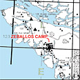 The mining and logging camp of Zeballos (pop. 272) is located on an arm of Esperanza Inlet, on the southwest side of Vancouver Island, British Columbia. Vancouver Island is 301 miles, by road, and reaches elevations as high as 7,249 feet.
The mining and logging camp of Zeballos (pop. 272) is located on an arm of Esperanza Inlet, on the southwest side of Vancouver Island, British Columbia. Vancouver Island is 301 miles, by road, and reaches elevations as high as 7,249 feet.
The Circle Goldfields
February 2006
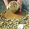 The Circle Goldfields are located about 120 miles east of Fairbanks in Interior Alaska and they occupy about 200 square miles. The Crazy Mountains boast the highest point in the district at 3,690 feet above sea level.
The Circle Goldfields are located about 120 miles east of Fairbanks in Interior Alaska and they occupy about 200 square miles. The Crazy Mountains boast the highest point in the district at 3,690 feet above sea level.
Update on the West Mojave Desert Planning Area
August 2001
It is our hope that the following information will help desert residents understand what is happening and prepare them with adequate knowledge and information to participate in the government process as allowed by the United States Constitution and provided for in public law.
It is our hope that the following information will help desert residents understand what is happening and prepare them with adequate knowledge and information to participate in the government process as allowed by the United States Constitution and provided for in public law.
Subscription Required:
The Bawl Mill
• Our Readers Say
• Pacific Northwest Miners Request Help
• USFS Roadless Comments Reopened
• Flat-Fault Gold
• Basic Drywashing Principles
• Fields of Gold
• Picks & Pans: All That Glitters Pans Out Well!
• De Beers Undergoes Overhaul
• Gold in Michigan
• Update on the West Mojave Desert Planning Area
• 2001 Inductees to the National Mining Hall of Fame
• Company Notes
• The Spanish Silver of Mowry
• Melman on Gold & Silver
• Mining Stock Quotes and Mineral & Metal Prices