All Articles
Reading A River: Finding The Paystreaks—Part II
January 2009 by Chris Ralph
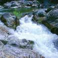 Just like the tilt of a sluice box, the grade of a stream greatly affects how gold accumulates in it. From very steep to nearly flat, all grade variations can be found in watercourses that contain gold-bearing gravels.
Additional articles that might interest you...
The Bawl Mill
September 1999
• So much for privacy in the great outdoors...
• It's smoky in the Smoky Mountains...
• A tale of two or three populations...
• That retirement nest egg may need to be grade A extra large...
• So much for privacy in the great outdoors...
• It's smoky in the Smoky Mountains...
• A tale of two or three populations...
• That retirement nest egg may need to be grade A extra large...
Ask the Experts
July 2014
Bacterial gold
Bacterial gold
Mining Firms Uneasy Over Bolivia
June 2006
Bolivia’s plan to nationalize its natural gas industry and exert greater state control over all of its natural resources has North American mining companies fretting over their future prospects extracting the nation’s rich resources of gold, silver and tin.
Bolivia’s plan to nationalize its natural gas industry and exert greater state control over all of its natural resources has North American mining companies fretting over their future prospects extracting the nation’s rich resources of gold, silver and tin.
Melman on Gold & Silver
May 2002
This was not a month for the weak-hearted. During the past thirty days, we have had an explosive intensification of the Middle East conflict, threats of OPEC using the “Oil Weapon” once again, a growing chain of events flowing out of the Enron collapse and...
This was not a month for the weak-hearted. During the past thirty days, we have had an explosive intensification of the Middle East conflict, threats of OPEC using the “Oil Weapon” once again, a growing chain of events flowing out of the Enron collapse and...
Twenty Minutes on a Five-inch Dredge
September 2013
The first thing I realized was this was not a toy—this thing had power and I needed to really pay attention. I got into position, took a deep breath, and pushed that monster into the hard pack.
The first thing I realized was this was not a toy—this thing had power and I needed to really pay attention. I got into position, took a deep breath, and pushed that monster into the hard pack.
The Bawl Mill
April 2002
• Feeding at the government trough
• Environmental group tops the US domestic terroritst list
• Some towns will do anything for tourism...
• Feeding at the government trough
• Environmental group tops the US domestic terroritst list
• Some towns will do anything for tourism...
Subscription Required:
The Bawl Mill
• A Word From the Editor
• Placer Gold in the Ortiz Mountains
• Miners Discuss Struggles at NWMA
• Ask The Experts—Where to Take Sulfide Ore for Processing
• Ask The Experts—Where Would The Most Gold Tend To Be In This Deposit?
• East Coast Dredger Heads West - Part I
• Growing Pains of the Learning Curve
• Stillwater At Half Speed
• Elko County Has Highest State Median Income
• Melman on Gold & Silver
• Mining Stock Quotes and Mineral & Metal Prices
• Pebble Deposit Reveals Mineral Potential