All Articles
The Golden Highway—Calaveras County
January 2004 by Frank Lorey III
Heading north along Highway 49 into the central Mother Lode, the first old mining town in Calaveras County was Melones, located along the banks of the Stanislaus River. The town was named for the unique coarse gold flakes found in the gravels that resembled melon seeds, hence the name that came from the Mexican miners.Additional articles that might interest you...
How California Became the Golden State
August 2010
On the morning of the 19th of January, 1848, Marshall went out to examine the cut and inspect the progress that had been made overnight.
On the morning of the 19th of January, 1848, Marshall went out to examine the cut and inspect the progress that had been made overnight.
Legislative and Regulatory Update
December 2002
• Federal election results should be favorable to miners
• Utah residents reject proposed National Monument
• Fish and Wildlife told to disclose locations of endangered species
• Federal election results should be favorable to miners
• Utah residents reject proposed National Monument
• Fish and Wildlife told to disclose locations of endangered species
Detectors: Past, Present and Future
June 2016
 Detectors were invented long before I was born, but it was in the 1960s when they started to become an item popular enough to power a fledgling industry. The key development was miniature transistor technology replacing the old fashioned tube technology of the 1950s, making lightweight, affordable detectors possible.
Detectors were invented long before I was born, but it was in the 1960s when they started to become an item popular enough to power a fledgling industry. The key development was miniature transistor technology replacing the old fashioned tube technology of the 1950s, making lightweight, affordable detectors possible.
Legislative and Regulatory Update
January 2000
• Inter-department letter, Forest Supervisor to Regional Forester seeks assistance in segregating a significant area of the San Bernardino National Forest from mineral entry.
• Conservation and Reinvestment Act (CARA) stopped in Senate Energy and Natural Resources Committee
• Forest Service meetings on Roadless Initiative have ended and the comment period closed December 20, but we have been advised that the public will have another opportunity for input.
• On November 8, the BLM held a hearing in Placerville, California, regarding withdrawal of 3,368.85 acres of public land along the South Fork of the American River.
Company Notes
February 2000
• Mountain Province Mining Inc.
• Shoreham Resources Ltd.
• Gemcom Software International
• Rio Tinto
• Mountain Province Mining Inc.
• Shoreham Resources Ltd.
• Gemcom Software International
• Rio Tinto
Adding Shine to Your Portfolio
December 2005
As inflation fears grow, some advisers are steering their clients into precious or industrial metals as a way to add luster to portfolios.
As inflation fears grow, some advisers are steering their clients into precious or industrial metals as a way to add luster to portfolios.
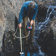
The Suction Gold Dredging Fight Continues in California
July 2009
The story is similar to what has played out over the past several years. The Karuk Tribe of northern California, with the support of several environmental and fishing groups, sues the California Department of Fish & Game in an attempt to stop suction gold dredging in the state. At the same time, they find a state legislator sympathetic to their cause and persuade the legislator to introduce a bill to stop suction gold dredging.
The story is similar to what has played out over the past several years. The Karuk Tribe of northern California, with the support of several environmental and fishing groups, sues the California Department of Fish & Game in an attempt to stop suction gold dredging in the state. At the same time, they find a state legislator sympathetic to their cause and persuade the legislator to introduce a bill to stop suction gold dredging.
Subscription Required:
The Bawl Mill
• From the Editor
• Our Readers Say
• Forest Occupancy Decision Stands—US Forest Service Withdraws Appeal
• World Gold Council Launches New Gold Bullion Securities
• Epithermal Gold-Quartz Veins
• Gold in Arkansas
• Picks & Pans: Winter Prospecting and "Forty Mile" Miller
• Company Eyes Reopening Mine Near Troy
• ICMJ's 13th Annual Photo Contest
• Company Notes
• A Guide to Overlooked Gold Deposits—Part V (Conclusion)
• Mining Stock Quotes and Mineral & Metal Prices
• Melman on Gold & Silver