All Articles
Our Readers Say
May 2003 by Staff
• "...writing from Kuwait..."• "...invaluable tools..."
• "Longtime prospector."
Additional articles that might interest you...
Agency Gives Initial Backing to Kensington Mine
June 2004
A state funding agency has given the initial OK to financing $20 million in debt to move the Kensington gold project near Juneau toward becoming a working mine.
A state funding agency has given the initial OK to financing $20 million in debt to move the Kensington gold project near Juneau toward becoming a working mine.
The Bawl Mill
May 2018
- Bio-mass is a bio-miss…
- Russia exploiting “useful idiots of unwitting environmental groups…”
- California has the best of the worst…
Legislative and Regulatory Update
April 2008
• FWS to delist gray wolf
• Miners need to be heard on wilderness bills
• HR 2016
• FWS to delist gray wolf
• Miners need to be heard on wilderness bills
• HR 2016
Gold Prospecting & Mining Summit Exceeds Expectations
May 2014
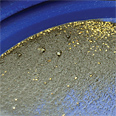 Brian...had cleared off some virgin, gold-bearing bedrock areas prior to our arrival, so everyone had ample opportunity to find and take home some gold.
Brian...had cleared off some virgin, gold-bearing bedrock areas prior to our arrival, so everyone had ample opportunity to find and take home some gold.
An Unusual Death in Downieville's Gold Rush
May 2000
While women were extremely rare in the early California gold camps, their relative absence did not always guarantee their safety or protection if they happened to be of Mexican nationality. The most memorable, graphic example of this tendency took place in Downieville, seat of Sierra County located on a fork of the Yuba River.
While women were extremely rare in the early California gold camps, their relative absence did not always guarantee their safety or protection if they happened to be of Mexican nationality. The most memorable, graphic example of this tendency took place in Downieville, seat of Sierra County located on a fork of the Yuba River.
Melman on Gold & Silver
May 2000
If there is one word which seems to describe the past month on so many fronts, it is the word "dysfunctional." The tone was set when "American Beauty" won the Academy Award for "Best Movie."
If there is one word which seems to describe the past month on so many fronts, it is the word "dysfunctional." The tone was set when "American Beauty" won the Academy Award for "Best Movie."
Subscription Required:
The Ball Mill
• WMD Raffle Raises Funds for Lawsuit
• Gold in Alabama
• From the Editor
• Yukon Placer Miners Fighting Extreme Discharge Limits
• Picks & Pans: Red Beryl Mining—Beaver County, Utah
• The Investigation
• A Gold Detector Sitting in a Closet Only Finds Dust—A Potpourri of Detector Tips
• Central Coast Ranges
• Poll: Montana in Favor of Repealing Anti-Mining Initiative
• Platinum in Laccoliths
• Mining Stock Quotes and Mineral & Metal Prices
• Looking Back
• Melman on Gold & Silver
Free:
Legislative and Regulatory Update
• BLM Runs Check on Assay Services