History & Geology
Undiscovered Placer Deposits in Alaska
November 2010 by Jim Halloran
Here is how I see the main opportunity for undiscovered placer gold. Imagine you are a prospector 125 years ago exploring the wilds of the Alaska territory. There are no roads, maps, nor aerial photographs. You must get around by traveling on the rivers and paddling upstream. You must go upstream because you came by ship at sea level. So you paddle and portage upstream into the hills and mountains. Each tributary stream you come to must be tested for gold. You hike upstream a bit, dig a hole in a gravel bar and take pan samples to see if any gold seems to be coming down that stream. If there is little to no gold, you head on up river. If enough gold is in your pan, then you go up that tributary and maybe make a discovery.
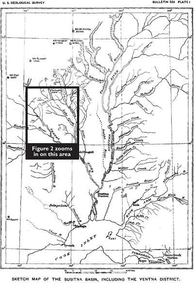
Remember back during the gold rush, you had no maps or aerial photos—not even Google Earth! Figure 1 is a USGS map published in 1913, which was prepared by properly trained surveyors. The map in figure 1 was made 20 years after the prospecting trip and it only shows one large lake and no bogs.
Figure 2 is a USGS map made a half century later of the southern Cache Creek Mining District, which presents many large lakes, hundreds of small lakes and a mind-boggling number of bogs that are actually in the rectangle in Figure 1.
Nobody in those days knew what was upstream, out of view. It was possible and often probable that there was a lake and bog upstream beyond their knowledge. A lake is a big sediment trap. Any gold that washed into the lake would be forever trapped there. It is possible a rich placer stream could be feeding into a lake and no further. How many lakes are in Alaska and the Yukon? Thousands or perhaps tens of thousands!
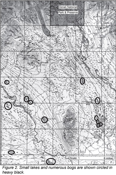
What is a bog? A bog is a vegetation-filled lake. How many bogs are there in Alaska and the Yukon? Hundreds of thousands, perhaps. Streams flowing out of bogs and lakes are usually sediment free. If there is any stream sediment, it is clay-sized particles in suspension. Nothing of any size escapes a large sediment trap like a lake or bog. It is likely that gold rush prospectors never went far enough up the tributary to reach the bonanza.
Lakes and bogs are more prevalent in glaciated regions because glaciers rearrange stream drainages drastically and can leave many lakes in their wake to become sediment traps. Unglaciated landscapes have fewer lakes because they have had millions of years to erode away lakes.
Another scenario for undiscovered placer gold is the Valdez Creek placer model. Valdez Creek is a rich placer stream discovered in the Alaska Range during the early gold rush days. It was discovered by prospectors working their way up the Susitna River in the manor described previously. They came to Valdez Creek, found good values, and followed the gold upstream to where they suddenly ran out of the yellow metal.
The Valdez Creek prospectors then searched the hillsides until they found the buried Tammany Channel, which they drift mined quite profitably (Figure 3). The Tammany is an auriferous stream channel that was buried by Ice Age glaciers. After decades of abandonment, a mining company began exploring for an extension of the Tammany Channel with geophysics and drilling rigs about 30 years ago. They found a rich channel. To their surprise, it was not the Tammany, but another rich channel. Neither of these channels could be seen from the surface because they were completely
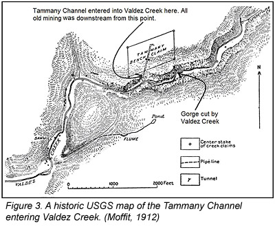 buried with glacial debris like outwash gravels. The old prospectors at Valdez Creek would have had nothing to discover if the creek had not intersected the old Tammany Channel. These two very rich channels would be undiscovered today if Valdez Creek had not essentially made the discovery possible. There are millions of acres of glacial outwash in the northern Rockies and many more opportunities for the Valdez Creek model to exist.
The Cariboo Mining District in northern British Columbia is a similar glaciated mining district. These conditions don’t just apply to Alaska and the Yukon; they apply to western Canada and even to the mountainous western United States.
Remote areas of the northern Rockies have not been thoroughly prospected for placer gold deposits. Today’s prospector has the advantage of using accurate maps, aerial photos and even geologic maps to help in explorations. Not only that, we have airplanes, helicopters, all-terrain vehicles, satellite phones and many other modern gizmos like geophysical tools to make our job easier and more effective.
_______________
Sources
- Capps, S.R., 1913, Gold Placers of the Yentna District, US Geological Survey Bulletin 534.
- Moffit, F.H., 1912, Headwater Regions of Gulkana and Susitna Rivers, Alaska, US Geological Survey Bulletin 498.


Flood Plain Gold Deposits—What Are They Really?
 We just completed a trip to another river, and yes, there was definite movement and redistribution of gravels, and other prospectors have seen this as well.
Gold in the San Francisco District Oatman, Mohave County, Arizona
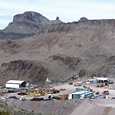 I suspect detailed geological mapping and prospecting would lead to discovery of one or more overlooked gold deposits in the district even though it has been heavily prospected in the past.
Reno's 1872 Time Capsule Includes Gold Rush Lore
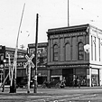 The Reno Masonic Lodge was built along the railroad tracks back when Ulysses S. Grant was president and shortly after the Comstock Lode of gold and silver was struck in Virginia City.
Critical Metals: Lithium
 Prospecting for lithium deposits can take a number of different directions, because this metal can be extracted from a variety of geologically differnet sources.
Mass Wasting & Gold Deposits
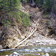 Not all of these slides and debris flows will produce results, but if you search for these while prospecting in your gold producing areas, then you can increase your odds of finding new gold.
Strategic Metals—Part II
 There are literally thousands of abandoned wasterock and ore dumps that dot the United States that could hold many tones of strategic metals.
Conrey Dredge No. 4
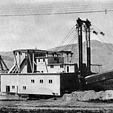 The large buckets were favorable for the type of ground worked. The gravel was tenacious and compact, due to the existence of irregular pockets of clay.
Subscription Required:
The Bawl Mill
• Legislative and Regulatory Update
• The Jenkins Mine Project, Conclusion—Recovery Operations & Summary
• Gold of Plumas County
• Recent Prospecting in Plumas County
• Prospecting for Nickel Deposits
• Detecting My Way Across Australia—Pt II
• Detectors Versus Pans
• Check The Box For Tax Savings
• Mining Stock Quotes & Mineral and Metal Prices
Free:
Melman on Gold & Silver